


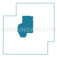
Voting District 3, Coal County, Oklahoma
About
Outline

Summary
| Unique Area Identifier | 653799 |
| Name | Voting District 3 |
| County | Coal County |
| State | Oklahoma |
| Area (square miles) | 54.54 |
| Land Area (square miles) | 54.34 |
| Water Area (square miles) | 0.20 |
| % of Land Area | 99.63 |
| % of Water Area | 0.37 |
| Latitude of the Internal Point | 34.62089710 |
| Longtitude of the Internal Point | -96.29863490 |
Maps


Graphs
Select a template below for downloading or customizing gragh for Voting District 3, Coal County, Oklahoma


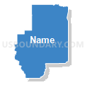

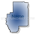

Neighbors
Neighoring Voting District (by Name) Neighboring Voting District on the Map
- Voting District 1, Coal County, OK
- Voting District 2, Coal County, OK
- Voting District 4, Coal County, OK
- Voting District 7, Coal County, OK
- Voting District 8, Coal County, OK